


While the Mountain State’s legendary back roads have long been a sentimental way for Appalachians to find their way home, these same roads have also offered endless adventures for those looking to get as far away from their abodes as possible.
The new Mon Forest Gravel and Bikepacking Route Network (MFRN), created by the Mon Forest Towns Partnership (MFT), seeks to take that sense of adventure to a new level via a slate of carefully curated cycling routes that guide riders through the deepest nooks and crannies of the Monongahela National Forest (the Mon).
An interconnected forest
The MFT formed in 2017 with a mission to grow a sustainable recreation economy by strengthening the connection between the Mon and its 12 gateway towns: Thomas, Davis, Parsons, Elkins, Petersburg, Seneca Rocks, Franklin, Durbin, Marlinton, Richwood, Cowen, and White Sulphur Springs.
The MFT currently operates under the fiscal agency of Woodlands Community Lenders, a community development and lending nonprofit based in Elkins. In true collaborative fashion, the MFT works alongside national, regional, and local partners, including the U.S. Forest Service, the Appalachian Regional Commission, West Virginia University Extension, local convention and visitors bureaus, and various volunteer groups.
Josh Nease is MFT’s executive director and its first full-time hire. He oversaw the creation of the MFRN and worked with the 12 partner towns and a bevy of board members to make the dream become reality. “Initially, people thought we were a marketing and tourism organization, but the work we’re doing is uniting a community-led network and developing thriving towns through this enhanced connection to our national forest,” he says. “We’re doing this to create not just a thriving economy, but an exceptional quality of life for the people that live here.”
Largest network in the East
West Virginia’s steep, rugged terrain has been well-known among mountain bikers for decades, but the advent of burly gravel bikes and overnight bikepacking gear has turned the recreation spotlight on the very roads that mountain bikers typically drive to reach singletrack trailheads. “We don’t need another multimillion-dollar mountain bike trail system,” Nease says. “We figured we can use what we already have to tell a more compelling story about who we are.”
The MFRN, currently considered the largest route network of its kind in the
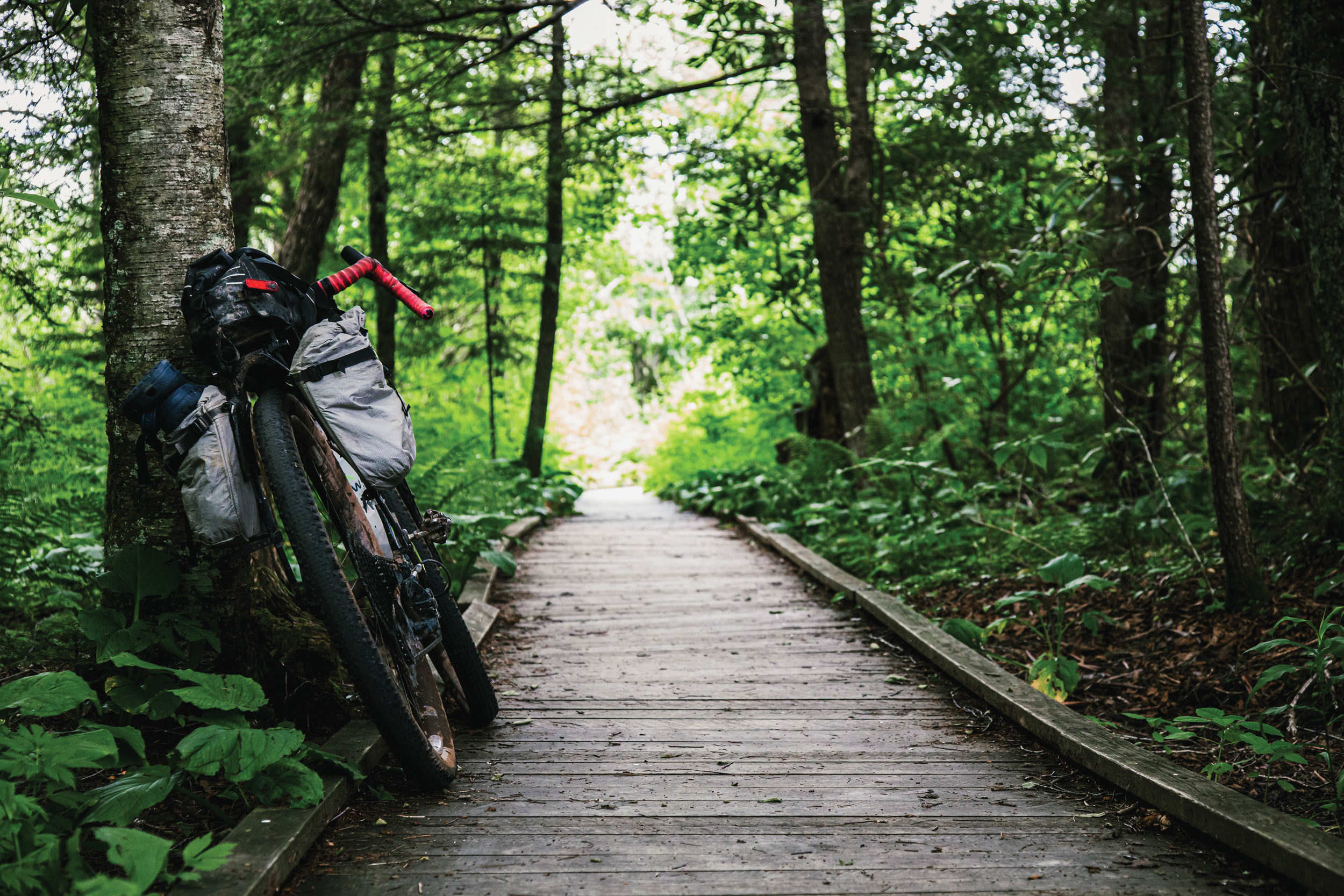
Eastern U.S., consists of 66 rides that traverse the roads that spiderweb through the Mon. The route list covers all eight counties that share a portion of the forest, and most routes pass through at least one of the 12 Mon Forest towns. Routes cover a wide range of distances, road surfaces, and landscape features. Skinny tire cruisers can find plenty of paved and packed gravel routes, while gravel grinders can explore the chunky gnar and loose descents on steep mountain roads. Those who prefer to bring their camping gear on mountain bikes can find a few singletrack-heavy routes that include traversing the epic spine of North Fork Mountain.
Eleven Signature Bikepacking routes cover regional highlights like the Cranberry River Trail, the Swiss hamlet of Helvetia, the old-growth forest of Gaudineer Knob, and the epic 220-mile option of the annual Gravel Race Up Spruce Knob (GRUSK). But the big kid on the block is the Mon Circuit 600—a 594-mile route with nearly 55,000 grueling feet of climbing that hits all 12 Mon Forest towns.
In May 2026, MFT hosted a launch in Marlinton for the MFRN. The three-day event included presentations, workshops, and a slew of group rides that took hundreds of participants on various single-day and overnight MFRN routes.
Since the official launch, Nease says
the response has been astounding. With more than 383,000 views across MFT’s digital platforms and 20,000 route views on Ride With GPS, a popular online platform that hosts the MFRN’s interactive map, the visitation data is providing proof of concept.
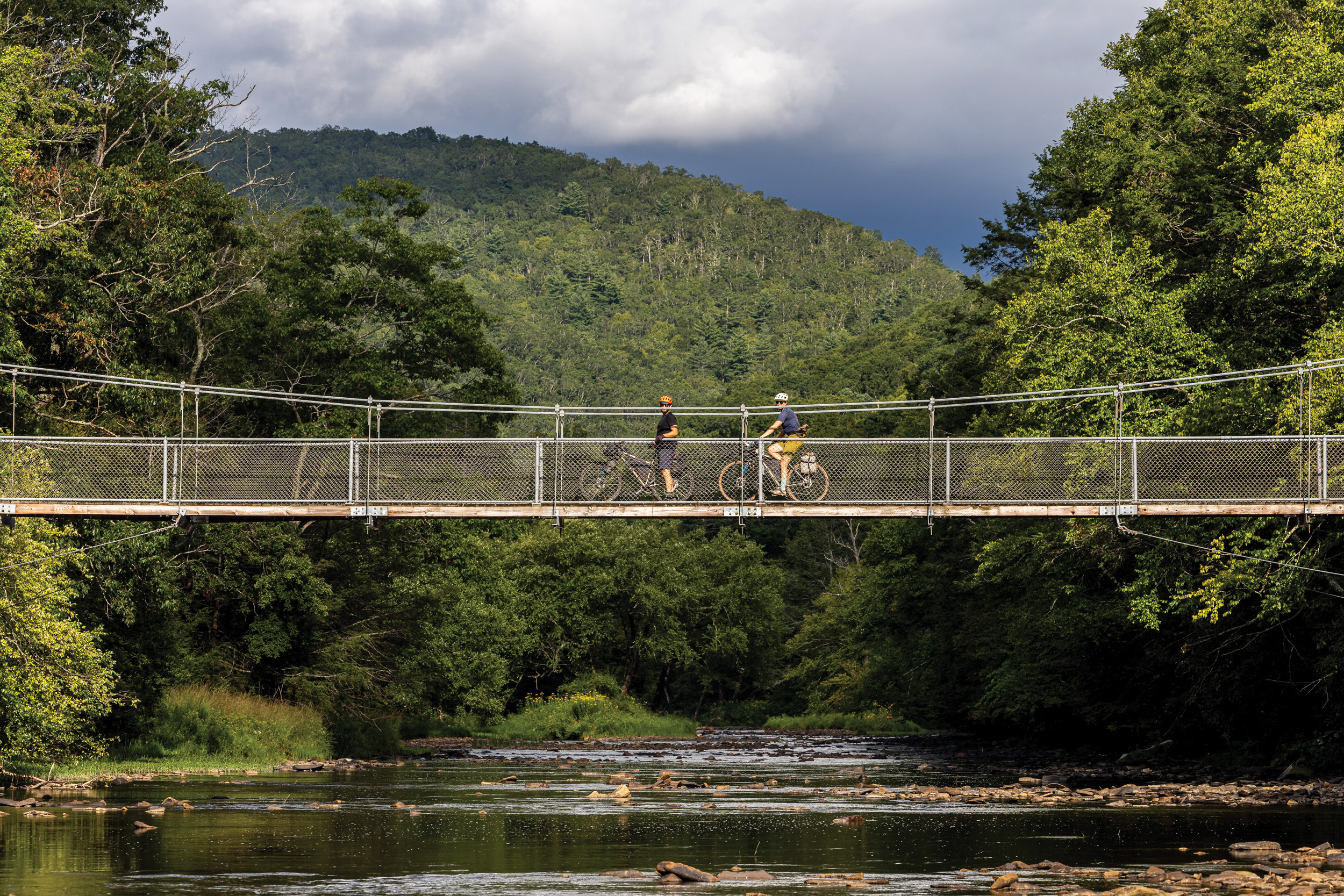
A rider narrowly crosses the Hosterman Trail Suspension Bridge that crosses the East Fork of the Greenbrier River near the Green Bank Observatory. Photographed by David Landis / Mon Forest Towns
Boots on the ground, tires on the gravel
Looking at maps to throw routes together and publishing them on the internet is one thing, but getting a crew of experienced cyclists to actually ride them all is a whole other beast. Fortunately for MFT, partners and town representatives stepped up and did the grueling legwork of double-checking every route for accuracy as well as getting GPS coordinates for things like food and water resupply stops, scenic viewpoints, and historical points of interest.
Experienced cyclists included Travis Olson, the curator of the beloved annual GRUSK event and owner of host company MountainRides; Alden Roth, an ultra-endurance bikepacker and outdoor filmmaker; Noelle Battle, executive director of advocacy group Bikepacking Roots; and David Landis, a bikepacking route developer and owner of route development outfit Village 2 Village Trails.
Landis, who designs epic cycling routes across the globe, was instrumental in bringing the MFRN to life. He’s created celebrated routes like the TransVirginia Bikepacking Route that connects Damascus, Virginia, to D.C., and the Mountaineer Monster, a cryptid-themed bikepacking race on chunky, primitive West Virginia backroads. “All of this has been a series of projects around bikepacking to promote communities, tell their stories, and create economic impacts,” Landis says.
He joined forces with Olson and others in the tightknit bikepacking community to combine their collective knowledge of West Virginia’s backroads. “I had spent the last 25 years riding in West Virginia, mapping out bikepacking routes to connect a lot of these places,” Landis says. “I already knew most of the roads super well and have a lot of deep connections here.”
Once the project was greenlit, Landis and company had to coordinate a series of town hall meetings in each Mon Forest town to build community buy-in and figure out where routes could go. “All kinds of folks would show up,” Landis says. “We’d tell them about the project and ask how they want to be involved.”
He then had a team of route creators submit various sections that had “a good story concept,” seemed to follow legal rights-of-way, flowed well, and offered resupply options. Next, digital routes were sent to a select team of riders who knew each area well enough to point out discrepancies like a road not existing anymore, perennially wet or muddy sections, or even routes that run adjacent to private properties with aggressive dogs. “We don’t mind putting people through pretty rough terrain as long as it’s legal and they’re not unsafe,” Landis says.
By the time the routes were drawn up, Landis says nearly 300 volunteers were ready and eager to hit the road. They had at least two people ride every route. “A lot of folks put the time in because they love the area so much,” Landis says. “We were able to do quite a lot with a short amount of time and produce a really extensive network.”
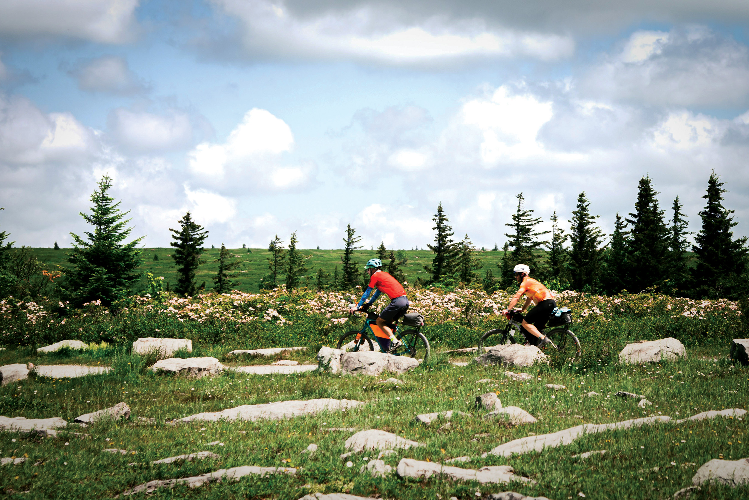
Bikepackers cruise along the windswept plains of the Allegheny Front on Forest Road 75 in the Dolly Sods Scenic Area. Photographed by Jonny Ramirez / Mon Forest Towns
DIY adventures
The MFRN—from the routes themselves to the online interface—was designed to welcome novice riders as well as those with experience. “It’s a great tool to explore new areas and plan a trip the way you would like to do it,” says Eric Matthews, an avid cyclist from Richmond, Virginia, who makes frequent trips to the Mon to ride MFRN routes with his wife. “It helped us visit West Virginia more than any other place in 2025.”
According to Matthews, the user-friendly online interface of the MFRN on Ride with GPS makes it a breeze for interested cyclists to find, research, and experience a route. “As a huge research nerd, I like to figure out as much as I can about an area before I go out,” he says.
“You always have the confidence to know everything has been pre-ridden, and you don’t have to worry about going through private property. You know what to expect because you have all the information provided for you before you pick up and go.”
Matthews’ favorite route thus far is the Cranberry Wilds, a 147-mile route that takes riders through Richwood and Marlinton and the upland bogs of the Cranberry River country. “Marlinton is such a cool town, and going through the wilderness of the Cranberry River was really special,” he says. “The landscape is so different compared to everything else in the region.”
Connectivity for the future
With the MFRN up and running and folks pouring into the region to experience the wealth of two-wheeled adventures, locals and visitors alike are wondering what’s next for MFT and its plans for forest connectivity.
Nease says there are a slew of new projects in the works, including the formation of a new MFT trails crew to tackle the backlog of trail maintenance in the North Zone of the Mon. “It’s a huge need,” he says. “Forest service volunteers are just working their tails off and can’t begin to keep up with the 500-plus miles of trails in the northern Mon, so creating a trails crew is something we’ve been endeavoring to do.”
Additionally, there are plans in various stages of development for new trails and increased connectivity all across the Mon. Some of the highlights include creation of a downtown trailhead in Marlinton that ties in with the Snowshoe Highlands Ride Center; a long-awaited multi-use trail to connect Davis and Thomas alongside Route 32; extensions of both the West Fork Rail Trail and Greenbrier River Trail into Durbin; an extension of the Cranberry Tri-Rivers Rail Trail into Richwood; a new singletrack loop system on Peters Mountain near Franklin; and a new stacked singletrack loop system near the mouth of Smokehole Canyon in Petersburg.
“That idea of connectivity looks different in each town,” Nease says. “These towns all have a ton of really committed and talented people going out to help find the funding for construction to provide that version of connectivity to the forest.”
A shared love for the forest
The central thread that ties everyone together is a shared love for the Mon, whether they’re a Mon Forest resident, a bikepacker who played a part in developing the routes, or a tourist traveling here to ride one of the 66 routes.
“The small towns we pass through end up being pretty cool; they leave a mark on us,” says Matthews. “We’ve explored several different areas by using the network, and it’s been nice to see some places that we wouldn’t have visited otherwise.”
Landis points to the quality of the forest roads and how they link everything—and everyone—together across the Mon. “There’s really no better place than right here in West Virginia to create a network of experiences like this,” he says. “These
roads are everywhere, and they’re in great shape. They’re like the connective tissue of the region.”
Landis’ ultimate wish is for people to come experience the MFRN. “I’d love to see people come and ride here. It’s such a special place. There’s so much depth to all the parts of the project, and I think West Virginia and Mon Forest Towns could be a pilot for this kind of thing across the country. I think West Virginians should be proud of what they have here.”
For Nease, the creation of the MFRN is yet another example of the MFT mission made manifest. “This is just such an awesome way to weave together existing forest roads and all this amazing recreation infrastructure. It physically and symbolically connects all of us through the forest.”