
River Gauges, Explained

River Gauges, Explained

United States Geological Survey gauge 01075000 on the Pemigewasset River at Woodstock, New Hampshire. This high water–mark monument was installed in May 2021 and shows that the peak for the period of record at this gauge was from Tropical Storm Irene in 2011. This gauge has reported peaks for 77 years. Photographed by Richard Kiah.

Heading to the river? Bring the right gear. Scope out the weather. And check the local river gauges—because the river decides if your boat moves, if the fish bite, and if you get home safely.

If you’re not sure how to do that, you’re not alone. Whitewater paddlers and fly fishermen talk about reading river gauges, but it can be confusing if you don’t know what the numbers are really telling you.

At the most basic level, rivers are measured in two ways: how high the water is and the volume of water moving downstream. In the past, people only measured river height, or stage. “People would paint lines on a bridge piling,” says Dave Jackson, a whitewater kayaker from Wheeling—and my brother. “That’s called a stick or foot gauge. Every one of those is going to be local and arbitrary. It’s simply telling you how high the water is at that moment, not how much water is actually moving.”

Many foot gauges are generations old. Stage numbers are unique—a reading of three feet on one stream might mean perfect conditions, while three feet on another could mean dangerously high water. Unless you know that stretch of river, the number alone doesn’t tell you much.

The other problem is that rivers don’t rise evenly. Most channels are shaped like a bowl, so when water gets higher, it spreads wider and deepens quickly. The difference between two and three feet might be minor, but the jump from seven to eight feet could be a huge increase in volume.

Modern river gauging is more reliable. The United States Geological Survey (USGS) monitors many streams and collects data on river height as well as volume, measured in cubic feet per second (CFS). “One cubic foot is roughly the size of a beach ball,” Jackson says. “So, if a river is flowing at 2,000 CFS, imagine 2,000 beach balls of water rushing downstream every second.”

CFS is useful because it’s standardized: 1,000 CFS always means the same amount of water. However, it’s important to remember that CFS numbers tell you how much water is moving, but not how that water will behave in a specific place. A gentle flow on the Cheat River might be a flood on its tributary, Big Sandy Creek. 

USGS gauge 01618000 on the Potomac River at Shepherdstown, West Virginia. Photographed by David Fisher.

“Context is everything,” Jackson says.

If this still feels like a lot of information—because it is—resources like the USGS’s water data website as well as American Whitewater’s website take a lot of the guesswork out of a day on the river. Both offer graphs and flow ranges that can help you decide whether water levels are low, ideal, or potentially dangerous.

Trends are especially important. Look at the graph. Are levels rising? Quickly? Think about the weather. Did it just rain? Is snow melting? Is the water swirling and muddy? This may not be your day. On the other hand, if levels are falling slowly, the fish may be biting. Pay attention. Use common sense and trust your gut—a rising four feet is quite different from a stable or falling four feet.

Still, the old ways sometimes work well. For smaller streams without gauges, people may rely on experience and visual clues: a certain rock disappearing, water reaching a fence post, or a familiar hydraulic changing character. Talk to locals if you’re unsure about river conditions—they’ll know. 

“Technology gives us numbers,” Jackson says, “but experience teaches us what those numbers mean.”

Every Mile Counts

Every Mile Counts

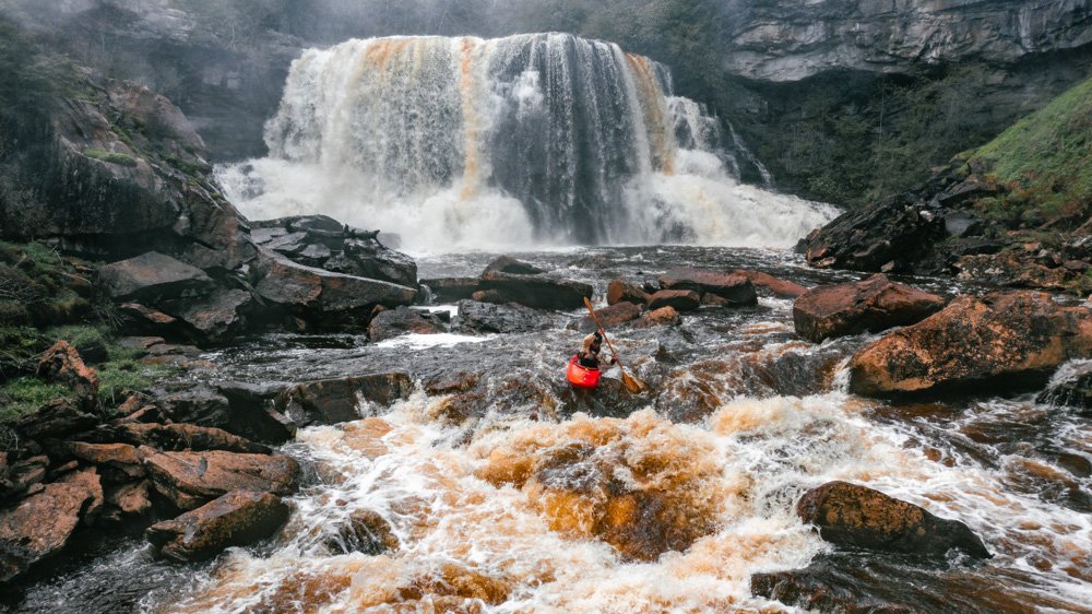
A day on Brush Creek—a tributary of the Bluestone River—turned dangerous when waters from Hurricane Helene turned Barket’s paddling adventure into a flash flood.

Water is the lifeblood of West Virginia, and its rivers are its veins. While hikers and bikers seek trails and skiers the slopes, paddlers venture into canyons and valleys. The creeks, branches, forks, and runs are conduits to explore these magic places. The rivers and gorges are cut and carved by Mother Nature herself, and it is a privilege to travel along her pathways. West Virginia is home to some of the best whitewater runs in the country and offers year-round paddling opportunities. For many like me, whitewater paddling is more than a hobby—it’s a way of life.

I discovered whitewater over 20 years ago and developed a passion for exploring new rivers. Since then, I have quietly been gathering intel, exploring rivers, and writing trip descriptions from whitewater runs across the Mid-Atlantic. After a push from a friend a few years back, I set a lofty goal to paddle, photograph, and document every whitewater river in the Mountain State in a new guidebook, Mountain State Whitewater: A Paddler’s Guide to the Rivers of West Virginia, Western Pennsylvania, Western Maryland, and Central Virginia.

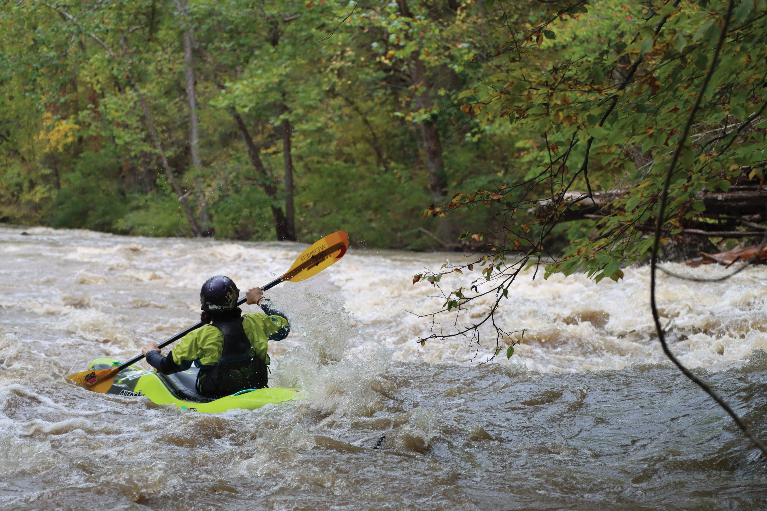
Paddling a stream as unique as Upper Seneca Creek required careful scouting around fallen trees and unexpected hazards. But quick thinking rewarded the boaters with a once-in-a-lifetime run.

Paddling on nature’s terms

A task like this is difficult, because many of the small streams in West Virginia take vast amounts of snowmelt or rain in order to make them navigable. Some run for less than a day or only a few days a year and require biblical rainfalls. These streams can have rapidly fluctuating water levels—there have been a few occasions where I’ve had to hike out of a run due to rapidly rising water under flash flood conditions. I often paddle on days when it is raining, snowing, or sleeting. Predicting when these streams are going to run takes years of experience, and a degree in meteorology might help, too.

Every time I go kayaking, a myriad of unknown variables can make or break the mission. These increase exponentially when traveling to a new run and region. One sweltering summer day, some fellow paddlers and I were nearly 20 miles into a 53-mile, two-day mission on the New River. We were trudging through the flatwater, wishing for a reprieve from the 90-degree heat. One soon came when a strong thunderstorm approached, appearing as a wall of water pouring out of the sky and a burst of wind swooping down into the valley. We scrambled to get to the middle of the river, out of the reach of trees that were being sheared off and stripped of leaves. After a few minutes of this violent weather, the wind ceased to blow and the temperature had dropped 20 degrees. We had our reprieve.

Plans can change quickly on a paddling weekend. In September of 2024, I rallied a crew to head down to the class II-III Bluestone River. The river was bankfull and a solid class harder than normal, so we dropped a vehicle at the takeout and diverted to a tributary named Brush Creek that was running due to the heavy rain the night before. We made our way downstream, running a 25-foot waterfall and several other steep class IV drops before reaching the flooded Bluestone. Paddling toward our takeout, we saw a floating porta-potty. The wooden guard railing that had previously surrounded the parking lot was now uprooted from the ground. In the middle of this floating stew, a kayak roof rack protruded from the water—the only part of my friends’ 4-Runner still visible. Unbeknownst to us, floodwater from Hurricane Helene had begun backing up behind Bluestone Dam on the New River, which in turn began filling up the river valley. The water would continue to rise for the next several days, covering the car with over 50 feet of water. It was recovered two weeks later when the lake finally receded.

Run of a lifetime

Some streams are extremely elusive and rarely have a navigable flow. I’d dreamed of paddling Upper Seneca Creek for over a decade. On our April 2024 descent, we paddled 18 miles of river from its source near Spruce Knob to the mouth. Even if you have some information about what to expect, paddling a new run is like riding a conveyor belt with unknown hazards around every bend. It takes caution and skill to anticipate horizon lines and decipher what can be run, what needs scouted, and what needs portaged—which we did around fallen trees 12 times, skipping over or ducking under 20 more. Although daunting, we were rewarded with one of the most beautiful and unique runs in the state. 

The hour-long shuttle wound up and over Spruce Knob, West Virginia’s highest point. The shuttle continued on foot along a tiny rivulet for a mile and a half until the small stream became large enough to float a kayak. As we progressed downstream, the creek steepened and accepted additional volume from numerous cascading tributaries. Where the gorge tightened, we found Seneca Creek Falls, a 25-foot waterfall. After a quick scout, we all ran the falls and pushed downstream. The rapids here are unique, as upthrust rock ledges run diagonal against the grain of the creek. 

With daylight fading, we made our way into the lower roadside section of Seneca. What began as a tiny rivulet had become a highwater delight that required lightning-fast moves and powerful strokes to clear river-wide hydraulics. Seven hours later, we arrived at our takeout in the shadow of the magnificent Seneca Rocks. We finished the day watching the sunset at Spruce Knob.

Despite that incredible adventure, checking a box for another run conquered ultimately doesn’t compare to the feeling of a river’s rhythm or the shadow of the mountains overhead. West Virginia is a landscape of extremes, from the tannic waters of the highlands to the thundering chaos of the Gauley. Paddle here long enough, and the water changes you. After 130 different whitewater sections in West Virginia, I’m still looking for the next mission. The adventure isn’t over—it’s just evolving. 

Paddling a stream as unique as Upper Seneca Creek required careful scouting around fallen trees and unexpected hazards. But quick thinking rewarded the boaters with a once-in-a-lifetime run.

Art Barket’s Mountain State Whitewater: A Paddler’s Guide to the Rivers of West Virginia, Western Pennsylvania,  Western Maryland, and Central Virginia will be released by Wolverine Publishing in August 2026.