by Dylan Jones | May 15, 2026 | Bike, Spring 2026
Roadies, rejoice! For the third year in a row, the USA Cycling Professional Road National Championships are coming back to the streets of Charleston for a weekend of two-wheeled action.
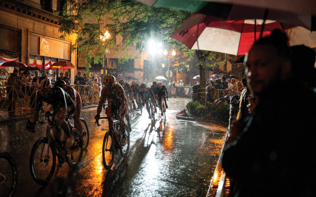
The championships take place across three main events. Time trials challenge riders to complete sections with the fastest time. The criterium has hungry racers competing neck-and-neck for an hour of laps around a 1-mile downtown course. Finally, a road race pushes the peloton to the limit on brutal hill climbs up steep streets around the Kanawha Valley.
“The criterium races are incredibly compelling—the speed, the strategy, the repetition of laps that allow you to watch tactics unfold in real time,” says Michael Basile, a Charleston local and managing member of Spilman Thomas & Battle. He stumbled upon the 2024 criterium race while walking to work and was so enthralled that he signed the firm on as this year’s presenting sponsor.
Lucas Bourgoyne won the 2024 men’s professional criterium and is amped up to return to Charleston to defend his title. “It was electric. The course was just packed with people going nuts,” he says. “It makes us excited to come back to West Virginia, because the community really shows up.”
In 2025, 422 riders from 49 states competed. Forty-six national champions were crowned with top honors. Racers are grouped into three age classes: juniors, under age 23, and elite—the veteran pros. The event was expanded in 2025 to include paracyclists.

Photographed by Perry Bennett
While the event is an up-and-coming favorite for Charlestonians and beyond, it’s also an economic boon for the Mountain State’s largest city. According to the Charleston Convention and Visitors Bureau (CVB), the 2025 event had an economic impact of $6.9 million, a 50% increase over spending from 2024—and that number is expected to increase as the event gains traction.
“We love seeing people get excited about cycling, and this event shines a big spotlight on Charleston as a premier cycling destination on the East Coast,” says Charleston CVB president Tim Brady. “The feedback from riders has been overwhelmingly positive. They love the course and the hospitality from the fans.”
This year’s USA Cycling Professional Road National Championships are scheduled for June 16–21, so be sure to pencil in those dates and start learning some cycling lexicon to shout during the fan-favorite criterium race.
by Laney Eichelberger | May 7, 2026 | Spring 2026, Wildlife
Photo Courtesy of Kevin Oxenrider
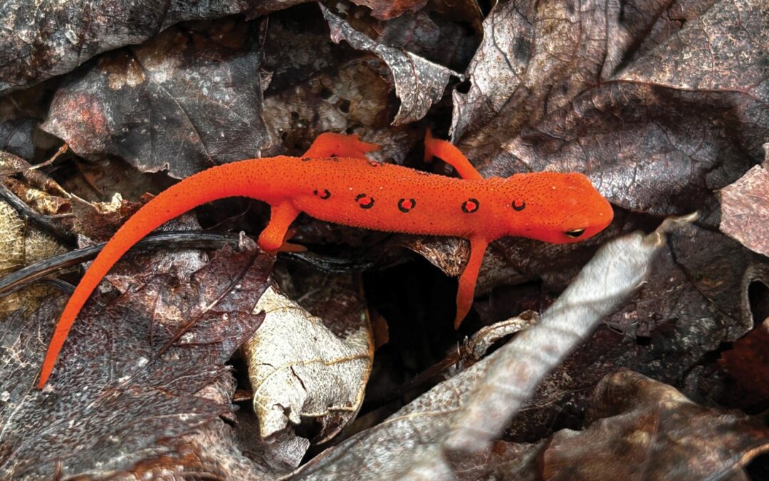
Appalachia has a lot of unique wildlife, but some of the region’s most quintessential critters are the many salamander species that frequent our rivers, creeks, springs, and moist—yes, we said moist—forests. Some are a more coveted find, like the elusive snot otter (AKA eastern hellbender, for folks who aren’t on a nickname basis with them), but they’re all iconic. Most people have stumbled upon the common, yet no less beloved eastern newt. Its juvenile stage is the most recognizable, with its striking orange coloration, fittingly known as a red eft.
Those sightings might not have felt like something to write home about. But they are something to write to the West Virginia Division of Natural Resources about, so put on your amateur herpetologist hat for an Eastern Newt Citizen Science Survey. You might be thinking, “If they’re so common, why does the WVDNR need us to count them?” Well, right now they’re a familiar sight in West Virginia and beyond—but that might not always be the case, thanks to a looming threat by the name of Batrachochytrium salamandrivorans, or Bsal.
Bsal is a species of chytrid fungus that causes chytridiomycosis, an amphibian fungal disease. The effects are like a zombie movie designed to scare baby salamanders into eating their vegetables. Parasitization of epidermal cells leads to skin lesions, weakening skin functions and causing death within just a few weeks. It’s yet to be documented in the United States, but scientists fear it’s only a matter of time before it arrives through avenues like the pet trade. And susceptibility trials show that eastern newts are especially vulnerable to the fungus.
“Salamandrivorans means ‘salamander devourer’ in Latin,” says Kevin Oxenrider, the WVDNR’s amphibian and reptile program leader. “It actually eats away at the skin, causing crazy water loss, which is a huge deal for amphibians. If they don’t have water, their skin isn’t permeable, which means they’re not breathing properly. It’s a really horrid way to go.”
So, how do we combat this Lovecraftian enemy? With good old-fashioned data, of course. It’s not as boring as it sounds, we promise. The more dramatic defensive measures—like ongoing trials of vaccines disseminated via waterways or other antifungal water treatments—will come later. But for now, scientists are ready to get ahead of the game by taking a snapshot of eastern newt distribution, pre-Bsal.
“Trying to restore a population is difficult when there is no baseline,” says Oxenrider, referencing the information gap of regional bat populations before the spread of white-nose syndrome. “We want to make sure that we have our ducks in a row to prepare for this disease.”
That’s where you come in. Until the survey ends in 2028, take the following steps:
- Stop the spread of disease by cleaning your gear—like shoes and boats—between outdoor expeditions.
- Spot an eastern newt anywhere in West Virginia, in any of its life stages.
- Snap a photo.
- Submit your findings at wvdnr.gov/plants-animals/surveys/eastern-newt-survey/.
- Sleep easy knowing you’re supporting the preservation of the Mountain State’s spectacular salamanders.
by Devin Lacy | May 7, 2026 | Fish, Spring 2026
Image Courtesy of Pendleton County CVB
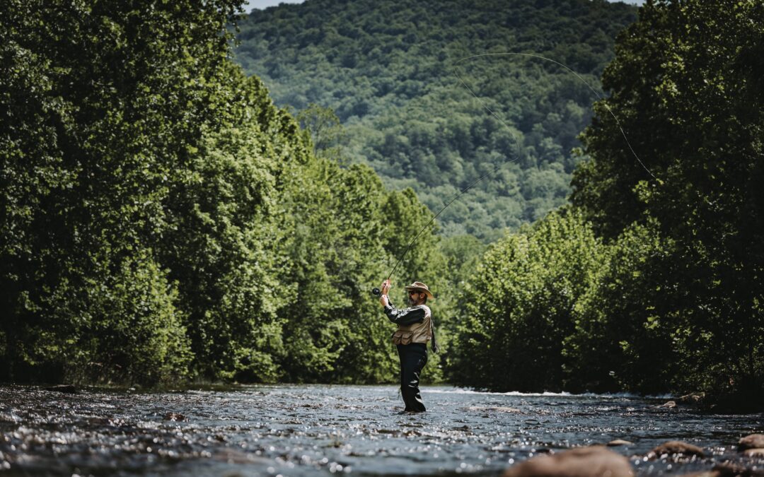
Cast a line and reel ’em on in—West Virginia Trout Fest is back on May 1–2, 2026! Growing from its early days as the Pendleton County Spring Festival, Trout Fest sprang from the Pendleton County Chamber of Commerce and the Convention and Visitors Bureau’s shared desire to use and honor their high-quality trout streams and draw visitors to the area. Now, in addition to live music jamming and artisan maker marveling, fest-goers can get a taste of local flavors at the Trout Dinner on Friday or bait their hooks and sign up for the Trout Rodeo on Saturday.
Each year, hundreds of anglers find spots along the South Branch Potomac River in Franklin and settle in for a day of fishing. Tagged trout are stocked in this portion of the river by Sugar Grove Trophy Trout Farm the night before, letting the fish settle in before lines start hitting the water. “We have all those tags listed, and if fishermen catch one, we have volunteers—stream marshalls—that must witness the catch and verify the tag,” says Pendleton County Chamber of Commerce Executive Director Jared VanMeter. A tag gives you the chance to win a variety of prizes, including a few cash-worthy catches.
When you’re not waiting patiently for fish to bite, take some time to check out the Treasure Mountain Festival Building, where the fun continues. Browse the wares of the outdoor and craft vendors who have set up shop. This is also where you’ll find an impressive line up of performances from regional musicians and bands as well as local businesses, including fan-favorite Raymond’s Gymnastics.
This may be VanMeter’s first year as executive director, but it’s definitely not his first rodeo. “I have been with the Chamber for a couple years now on the board, and I volunteered during Trout Fest—I love just helping out. My favorite part is stream marshalling, being down at the river and seeing the excitement.” While duties pull him to other festival responsibilities this year, he’s still eager to welcome participants to Franklin for a weekend of fun.
“I think it gives the community something to look forward to,” he says. “It celebrates our natural heritage and trout streams—our ties to the South Branch Potomac River. Tons of volunteers help out, and we couldn’t do it without them or the support of the community.”
by Laura Jackson | May 7, 2026 | Paddle, Spring 2026
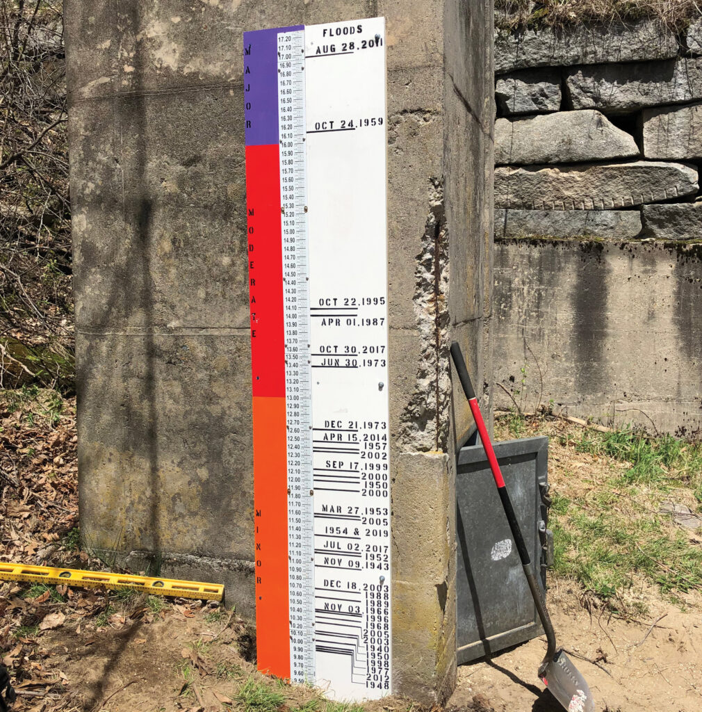
United States Geological Survey gauge 01075000 on the Pemigewasset River at Woodstock, New Hampshire. This high water–mark monument was installed in May 2021 and shows that the peak for the period of record at this gauge was from Tropical Storm Irene in 2011. This gauge has reported peaks for 77 years. Photographed by Richard Kiah.
Heading to the river? Bring the right gear. Scope out the weather. And check the local river gauges—because the river decides if your boat moves, if the fish bite, and if you get home safely.
If you’re not sure how to do that, you’re not alone. Whitewater paddlers and fly fishermen talk about reading river gauges, but it can be confusing if you don’t know what the numbers are really telling you.
At the most basic level, rivers are measured in two ways: how high the water is and the volume of water moving downstream. In the past, people only measured river height, or stage. “People would paint lines on a bridge piling,” says Dave Jackson, a whitewater kayaker from Wheeling—and my brother. “That’s called a stick or foot gauge. Every one of those is going to be local and arbitrary. It’s simply telling you how high the water is at that moment, not how much water is actually moving.”
Many foot gauges are generations old. Stage numbers are unique—a reading of three feet on one stream might mean perfect conditions, while three feet on another could mean dangerously high water. Unless you know that stretch of river, the number alone doesn’t tell you much.
The other problem is that rivers don’t rise evenly. Most channels are shaped like a bowl, so when water gets higher, it spreads wider and deepens quickly. The difference between two and three feet might be minor, but the jump from seven to eight feet could be a huge increase in volume.
Modern river gauging is more reliable. The United States Geological Survey (USGS) monitors many streams and collects data on river height as well as volume, measured in cubic feet per second (CFS). “One cubic foot is roughly the size of a beach ball,” Jackson says. “So, if a river is flowing at 2,000 CFS, imagine 2,000 beach balls of water rushing downstream every second.”
CFS is useful because it’s standardized: 1,000 CFS always means the same amount of water. However, it’s important to remember that CFS numbers tell you how much water is moving, but not how that water will behave in a specific place. A gentle flow on the Cheat River might be a flood on its tributary, Big Sandy Creek.
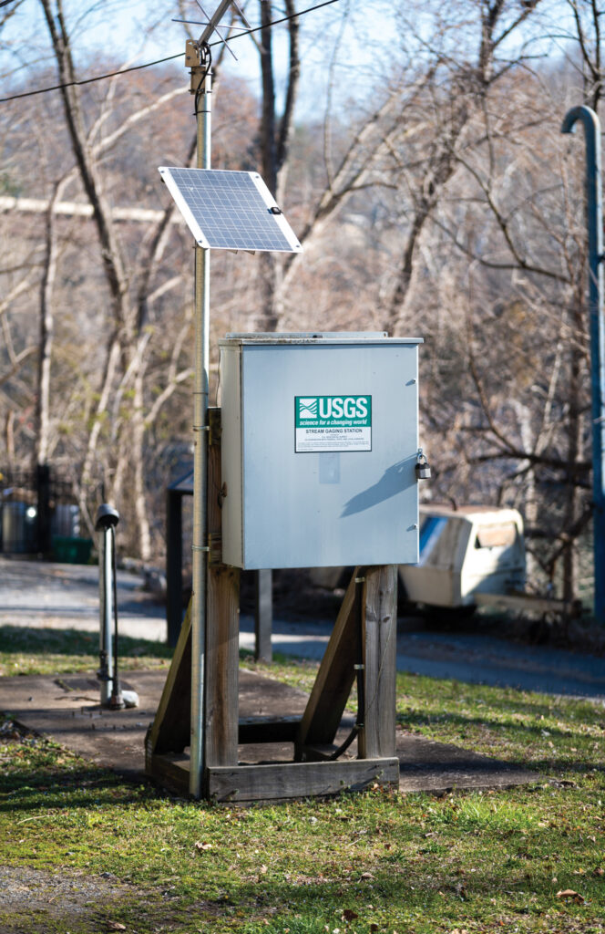
USGS gauge 01618000 on the Potomac River at Shepherdstown, West Virginia. Photographed by David Fisher.
“Context is everything,” Jackson says.
If this still feels like a lot of information—because it is—resources like the USGS’s water data website as well as American Whitewater’s website take a lot of the guesswork out of a day on the river. Both offer graphs and flow ranges that can help you decide whether water levels are low, ideal, or potentially dangerous.
Trends are especially important. Look at the graph. Are levels rising? Quickly? Think about the weather. Did it just rain? Is snow melting? Is the water swirling and muddy? This may not be your day. On the other hand, if levels are falling slowly, the fish may be biting. Pay attention. Use common sense and trust your gut—a rising four feet is quite different from a stable or falling four feet.
Still, the old ways sometimes work well. For smaller streams without gauges, people may rely on experience and visual clues: a certain rock disappearing, water reaching a fence post, or a familiar hydraulic changing character. Talk to locals if you’re unsure about river conditions—they’ll know.
“Technology gives us numbers,” Jackson says, “but experience teaches us what those numbers mean.”
by Pam Kasey | Apr 14, 2026 | Destinations, Spring 2026
Photographed by Nikki Bowman Mills
In 2015, a woman moved home to her roots in southwestern Pennsylvania and bought an old red brick building she’d loved as a child. The woman was internationally recognized mosaic artist Rachel Sager. The building was the former office of an abandoned coal mine on the property.
The Pittsburgh coal seam ran close to the surface here at the community of Whitsett and, back in the late 1800s, small, independent mines harvested valuable bituminous coal by hand. Over time, those little mines got bought out by corporate operations that drew workers and anchored communities.
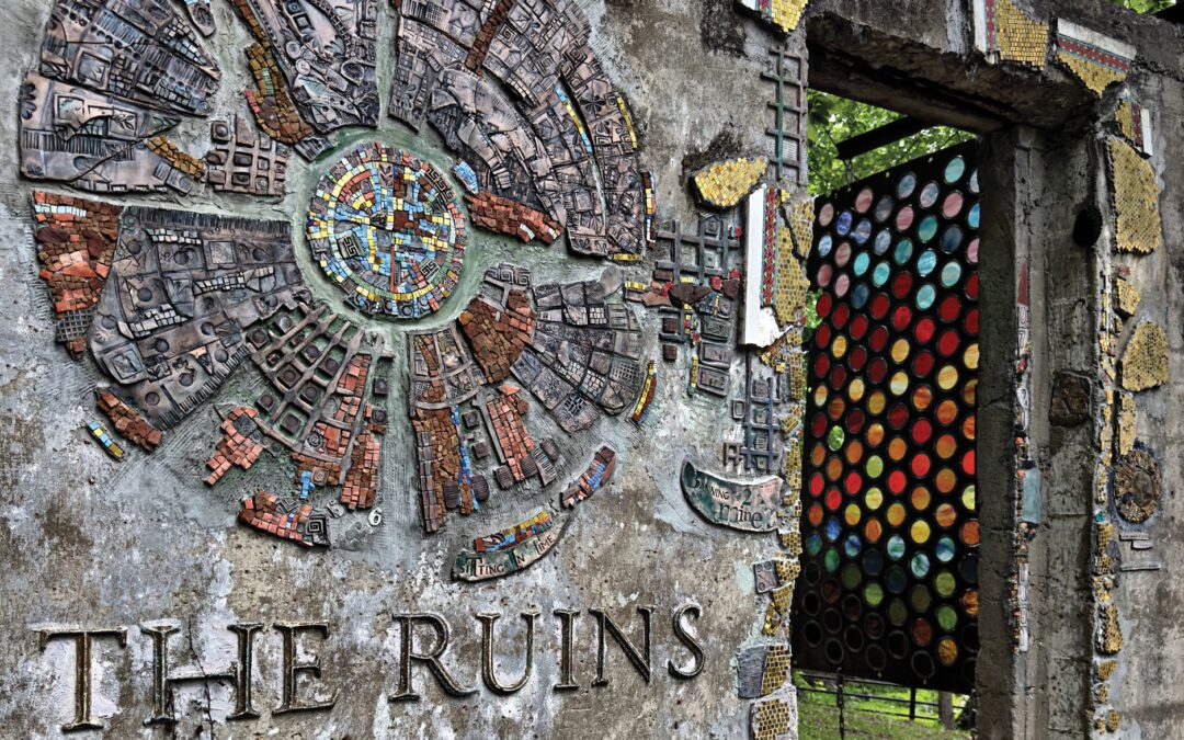
The big mines are gone now, too. But as the descendant of three generations of miners, Sager felt the history of her property powerfully all around her. And as a mosaic artist, she saw potential in the blank walls of the mine’s derelict structures. Over the past decade, she’s invited hundreds of artists to join her in creating a collaborative living art installation and memorial on those walls. The guided tour of Sager’s Ruins Project is a walk through a kaleidoscopic celebration of place.
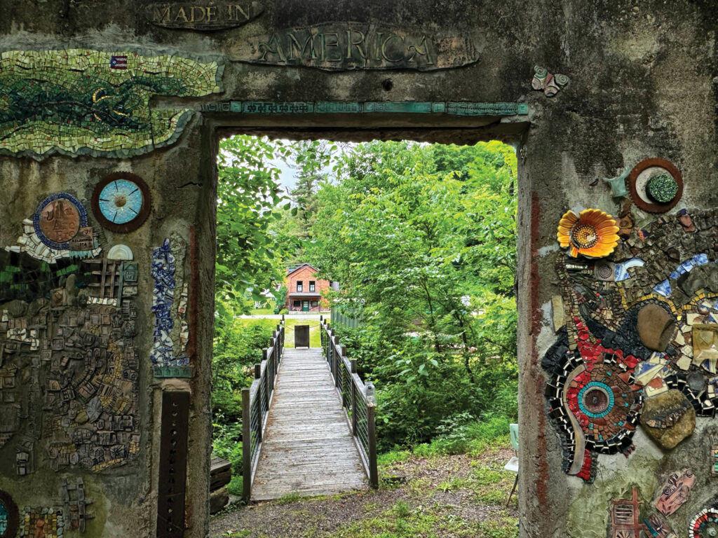
The Ruins Project tour tells stories—depicted in mosaic art—of the coal mine that once operated on the property in Fayette County.
The tour starts at a doorless opening in the old tipple, where coal was collected for loading into railroad cars. Around the doorway, glass and imprinted clay tiles are arranged in textured patterns that blend organically into the rough old concrete and mark this as a special place.
The original mine on Sager’s property opened in 1891. It was run by the Whitsett and Luce families and, for a time, was called Rainbow Coal Company. Soon after, Pittsburgh Coal Company bought it, along with a string of other small mines that dotted the Youghiogheny River valley. The Rainbow mine was renamed, less whimsically, Banning #2, and it was the most productive of the lot, with more than 600 miners at its peak. Banning #2 operated until 1946, and the ancestors of many of today’s locals worked there. Some died there.
Sager asks artists and visitors to “honor what was.” That means respecting the labor and lives that brought coal out of the ground to be smoldered in nearby coke ovens, then sent to the Pittsburgh steel mills to power the building of this country.
The mosaics honor that, and more.
Many of the mosaic pieces are made from materials found on the site, like sandstone, shale, and Youghiogheny Glass made in Connellsville.
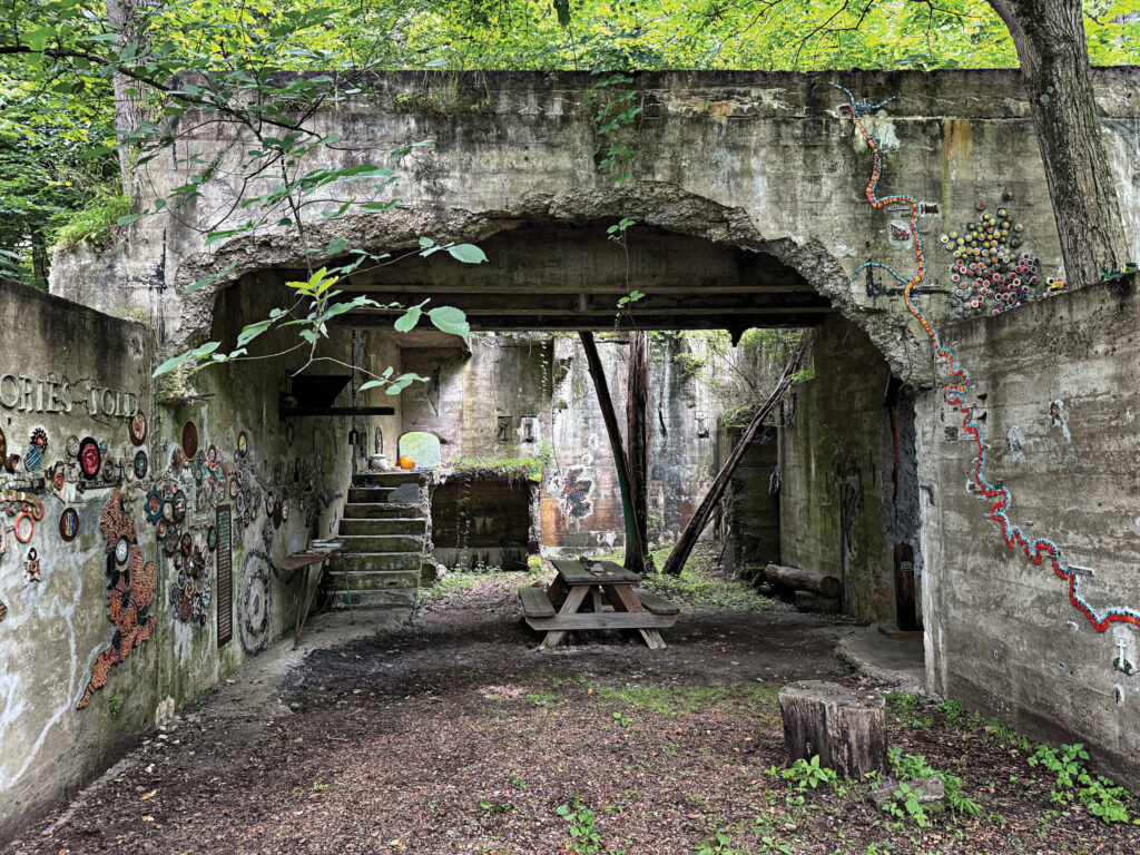
In the roofless room beyond that first doorway, a long glass-tile line makes its crooked way across two walls. It marks the path of the 150-mile Great Allegheny Passage rail-trail that runs from Pittsburgh to Cumberland, Maryland, and passes alongside The Ruins Project. The GAP trail is made up in part of the former Pittsburgh & Lake Erie Railroad line that served the Youghiogheny Valley mines, and Whitsett and other mining communities are located along the line on the wall. In the same room, the opposite wall holds works unified by a meander of gears of all shapes and sizes, some with teeth interlocking, many filled with round mosaics contributed by artists from all over the world.
Materials matter. Mosaic pieces here include sandstone, shale, and red dog—a mining byproduct—found on the site, Youghiogheny Glass made in nearby Connellsville, irregular pieces of fired clay, and more.
The artist, Rachel Sager, encourages visitors to honor the past and the people whose labor produced American coal and steel.
The tour wanders among crumbling walls past abstract and realistic mosaics, each with a story. A beehive with a fire at its center represents the tens of thousands of “beehive” ovens where coal was purified into hot-burning coke—this one is circled by buzzing bees. Fayette County wildlife shows up: birds, porcupines, a fox, an incredibly detailed turkey. A collection of small, multicolor hexagon mosaics by hundreds of artists brightens the exterior corner of the brick fanhouse. The dozen-foot-long shaft of an outsize arrow is artist Wendy Casperson’s yearslong project recognizing the Native people who once lived here.
One of the rooms holds mosaic portraits of real people who were connected with the mine—the face of a miner who died there at age 23, teenage sons of miners captured in a Polaroid taken just weeks after the mine closed, others. The largest installation, a 67-foot-long engine and cars of the P&LE Railroad, was completed by Pittsburgh mosaic artist Stevo in under three months.
The Ruins Project is full of stories and surprises. The opportunity to walk among the ruins of a mining operation is rare enough—but to do it while seeing its history portrayed so lovingly by a variety of artists is extraordinary.
Tours must be scheduled in advance by visiting Sager’s website—visitors without reservations are welcomed to the shop and studio only. The hour-plus walk covers level but uneven ground, so wear closed-toe shoes and dress for the weather. A great way to visit is to plan a hike or bike trip on the GAP trail—Sager Mosaics lies between mile markers 104 and 105, near the trail parking at Whitsett.
by Dylan Jones | Apr 10, 2026 | Bike, Spring 2026
Images courtesy of Wood County CVB
Just outside Parkersburg, Mountwood Park sits tucked among the hills and hollows that dot the landscape in Wood County. As with many county parks, you can fish, camp, and picnic.
But Mountwood is so much more. Its past includes a rich history of oil and technological innovation. Today, it boasts one of the Mountain State’s most beloved mountain biking trail systems and longest-running mountain bike races. A dedicated group of locals make this park and its legendary group of trails worth a visit for bikers of any skill level.
West Virginia’s only volcano
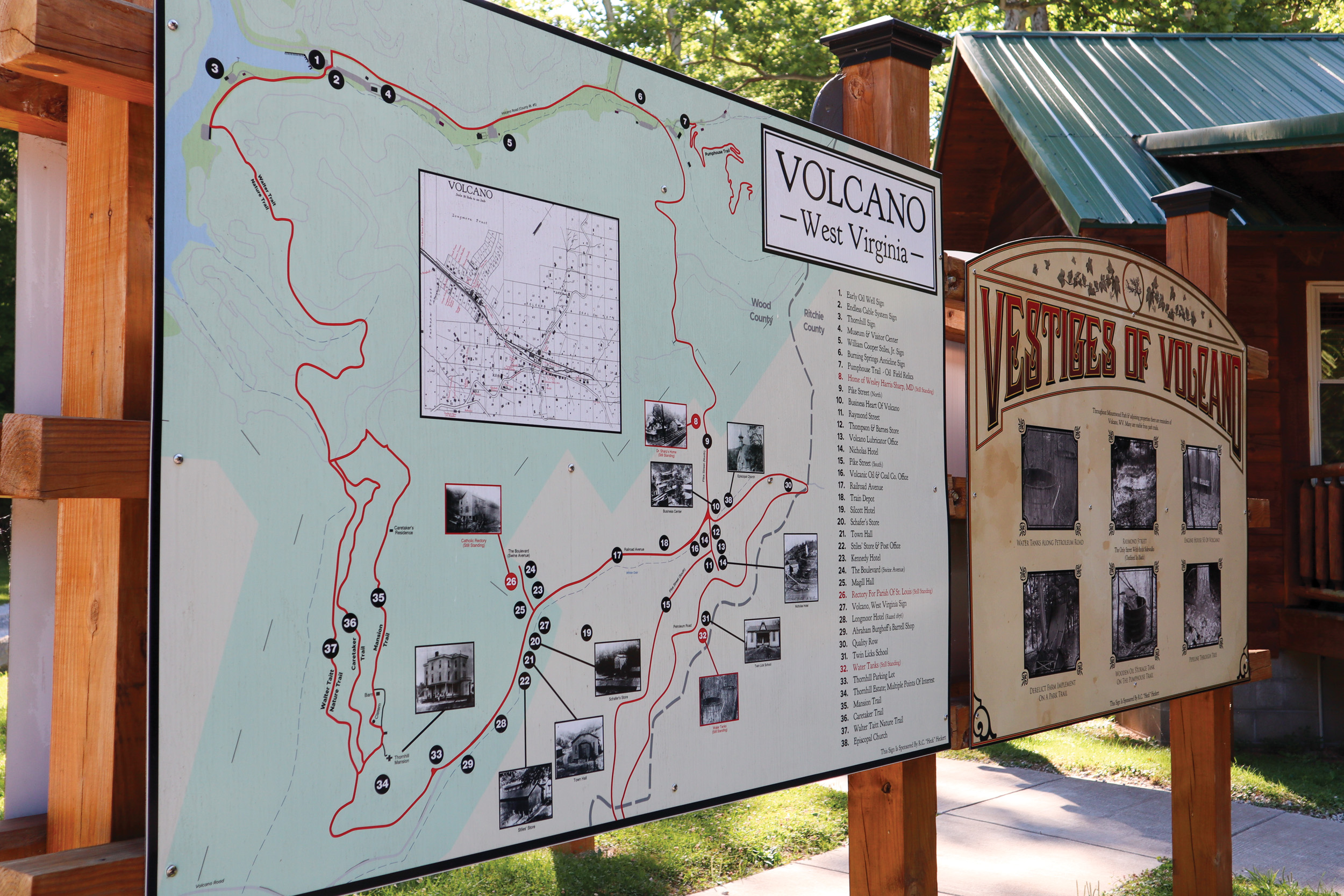
While the Mountain State isn’t known for liquid-hot magma, it was home to the town of Volcano. In 1860, the third-known oil field to be discovered in the United States was found in the ground beneath Volcano, a few miles from the Ohio River in Wood County. Like many other resource-rich locales of the era, Volcano quickly blew up into a boomtown, reaching a maximum population of 5,000. Industrialists here invented the endless cable system—a technological advancement used to perpetually pump oil from the vast reserves below the town’s bustling streets. “A lot of the technology that later helped with the development of the oil and gas industry got its start right here,” says Chris Swarr, Wood County Parks and Recreation Commission board chair. “The entire park is a fascinating history lesson.”
In 1879, a massive conflagration erupted and burned the aptly named town to the ground. Volcano never recovered, and the charred remains became another industrial ghost town. Present-day Mountwood Park encompasses Volcano’s ruins. Its history and the rusty relics—including the restored components of the endless cable system—remain on display, complete with interpretive historical markers. The town’s boom-and-bust history is celebrated at Mountwood each September during Volcano Days, marking one of the region’s biggest festivals.
Something for everyone
Nowadays, Mountwood Park encompasses over 2,600 acres and features nearly 45 miles of trails, a 50-acre lake, and many other recreational facilities. But the park is best known for its sinuous network of singletrack mountain biking trails that offer something for every level of rider. Also boasting updated signage and informational kiosks, Mountwood is one of five featured trail systems for the fledgling Mountaineer Trail Network Recreation Authority, on which Swarr serves as board chair.
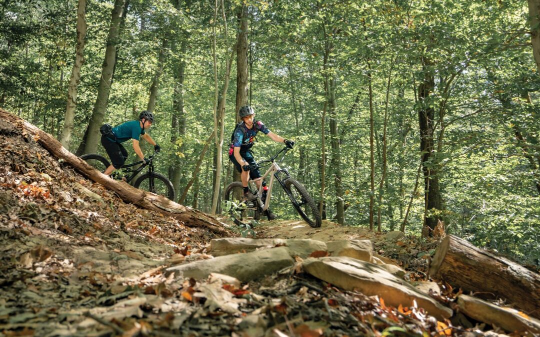
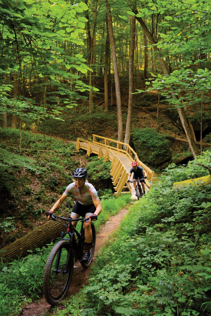
Trails weave throughout the steep western West Virginia terrain. The mostly hand-built trail system features everything from loamy flow to rocky tech, including natural and hand-built features, wooden bridges, and bermed turns that will leave a dirt-smattered smile on your face. A few miles of machine-built flow tail were installed by local trailbuilder Appalachian Dirt in 2018 to offer additional trail diversity.
“It’s heavily forested, rugged, and steep,” Swarr says. “The Burning Springs anticline is the main geologic feature here in Wood County, so some slopes are as steep as 70 degrees and very rocky.”
This topography leads to exciting trails that slice across slopes on bench-cut terraces, straddle the tops of narrow ridges, and, as Swarr puts it, plummet to “screaming-fun downhills. It’s hard to have a bad ride here.”
Lovingly maintained
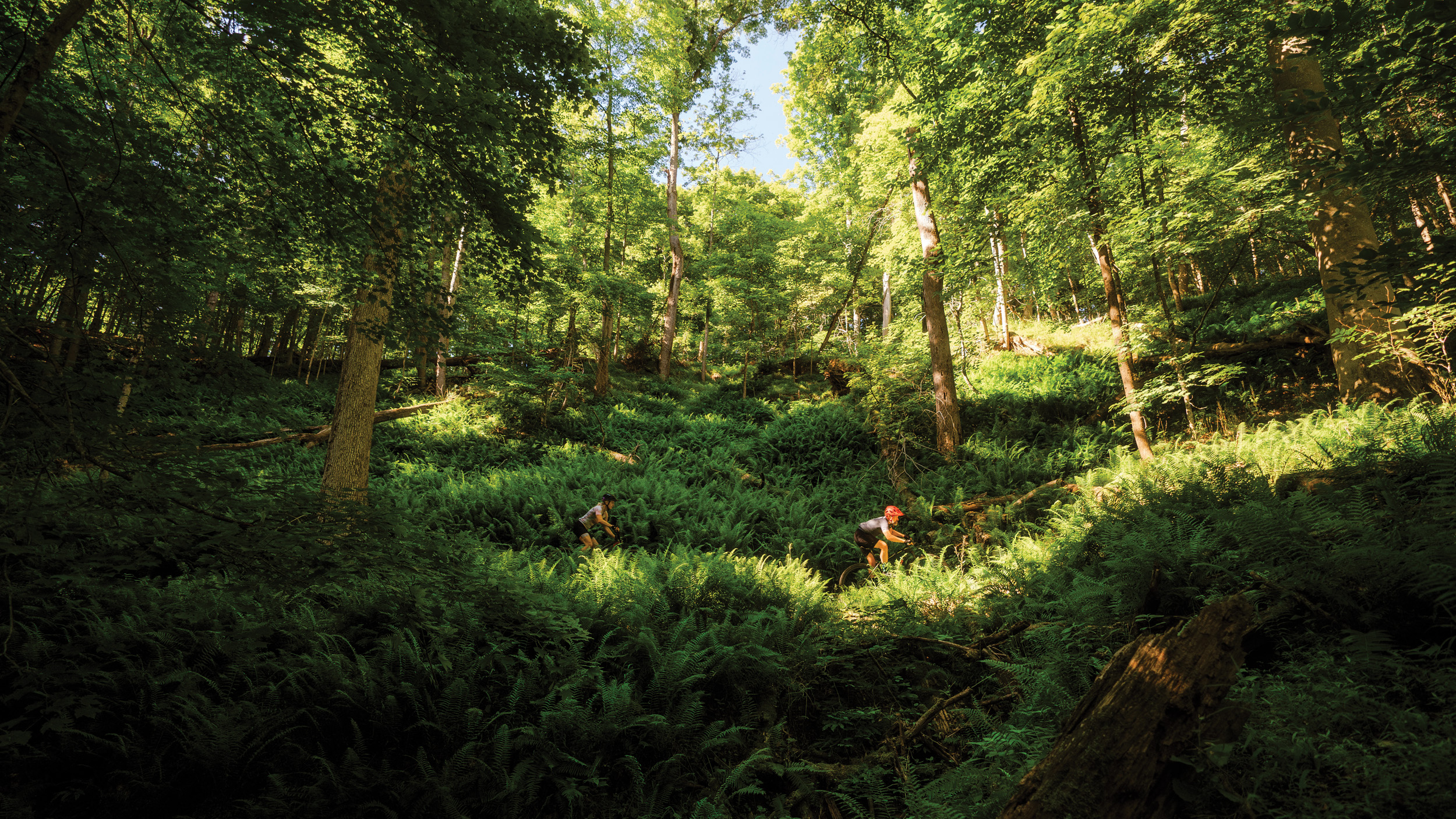
Those 45 miles of trail don’t maintain themselves—it takes a dedicated crew of local volunteers to keep the trails clear and manage drainage. That crew is the River Valley Mountain Bike Association (RVMBA), a group of locals who put in the time and sweat equity to make Mountwood the beloved system it is today. “I love Mountwood because it’s largely hand-built with care and love,” says Vince Nedeff, RVMBA vice president. “We have a small but mighty crew made of volunteer trail builders from all professions and perspectives. We’ll be standing around arguing about where the trail should go, then five minutes later we’re building something truly beautiful.”
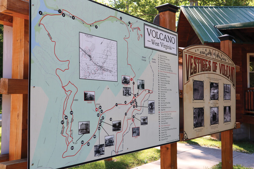
Interpretive signage helps visitors dive into the rich history of Volcano, a ghost town that was once home to an early oil boom and industrial innovations that shaped American life.
Beyond the dedicated members of RVMBA, Nedeff points to a special synergy found in the partnerships between the county, the park, and the volunteers—something that seems rare in this day and age. “Wood County, Mountwood Park administration, and RVMBA have a great 30-year relationship that facilitates providing an experience like this in a county park,” says Nedeff. “We don’t have state park money—it’s all a labor of love, and getting the Wood County Commission on board is a good example of local government serving its constituents and creating something there’s demand for.”
A classic challenge
The Mountain State is home to many legendary mountain bike races, and the Challenge at Mountwood—one of the longest-running mountain bike races in the state—is considered by some to be the grandaddy of them all. Running every year (save for 2020 due to COVID restrictions) since 1995, the Challenge at Mountwood has been around almost as long as mountain bikes themselves. The 20-mile Expert race climbs 2,600 feet over 20 miles, making it a test for even the most hardened race vets. At its height, Nedeff says the Challenge had more than 350 racers vying for a spot on the podium.
While the Challenge at Mountwood has created countless memories over the years, Nedeff, who’s been involved with the race for decades, says his happiest memory is when the race returned in 2021 following its COVID hiatus. “I got burnt out on racing, but I find so much joy in putting on a race for other people,” he says. “Seeing the joy on everyone’s faces and everyone racing again, that’s why we do it.”
Building off Volcano’s fiery past, Mountwood Park’s future looks to be just as bright. Swarr says big things are in store, including new downhill-style gravity trails, more skills park–style features, and plans to construct more machine-built flow trails. Additionally, plans to expand camping are in play, allowing more riders to come set up shop and ride right from camp. “It’s going to further enhance what’s already a great trail system,” Swarr says.
At the end of the day, you can plop a trail system anywhere, but the organic sense of community that forms and imbues it with love and pride can’t be manufactured. That takes time, and Mountwood Park has that history in spades. “I’ve biked in a bunch of places all over the country, but I just keep coming back to Mountwood,” Nedeff says. “I may be a little biased, but it’s always my favorite place to ride.”