


ENVISION THIS:
You’re deep in the Dolly Sods Wilderness, thousands of feet above sea level, enveloped in every direction by the sweeping landscape of the Monongahela National Forest. You’ve just summited Mount Porte Crayon, the sixth-highest point in the Mountain State. The journey wasn’t easy—you fought buffeting westerly winds, pushed through mature red spruce groves interspersed with dense young growth, and navigated moss plumes, impish ferns, and fallen spruce needles of years past in place of a forest floor. The uncanny ecosystem has you feeling like a pioneer of a far-off land. After 15 miles of bushwhacking and rock-clambering, you’ve made it.
With crisp, clear mountain air filling your lungs and an unforgettable view at your front, how could your adventure possibly get any better? Easily—just track down some treasure.
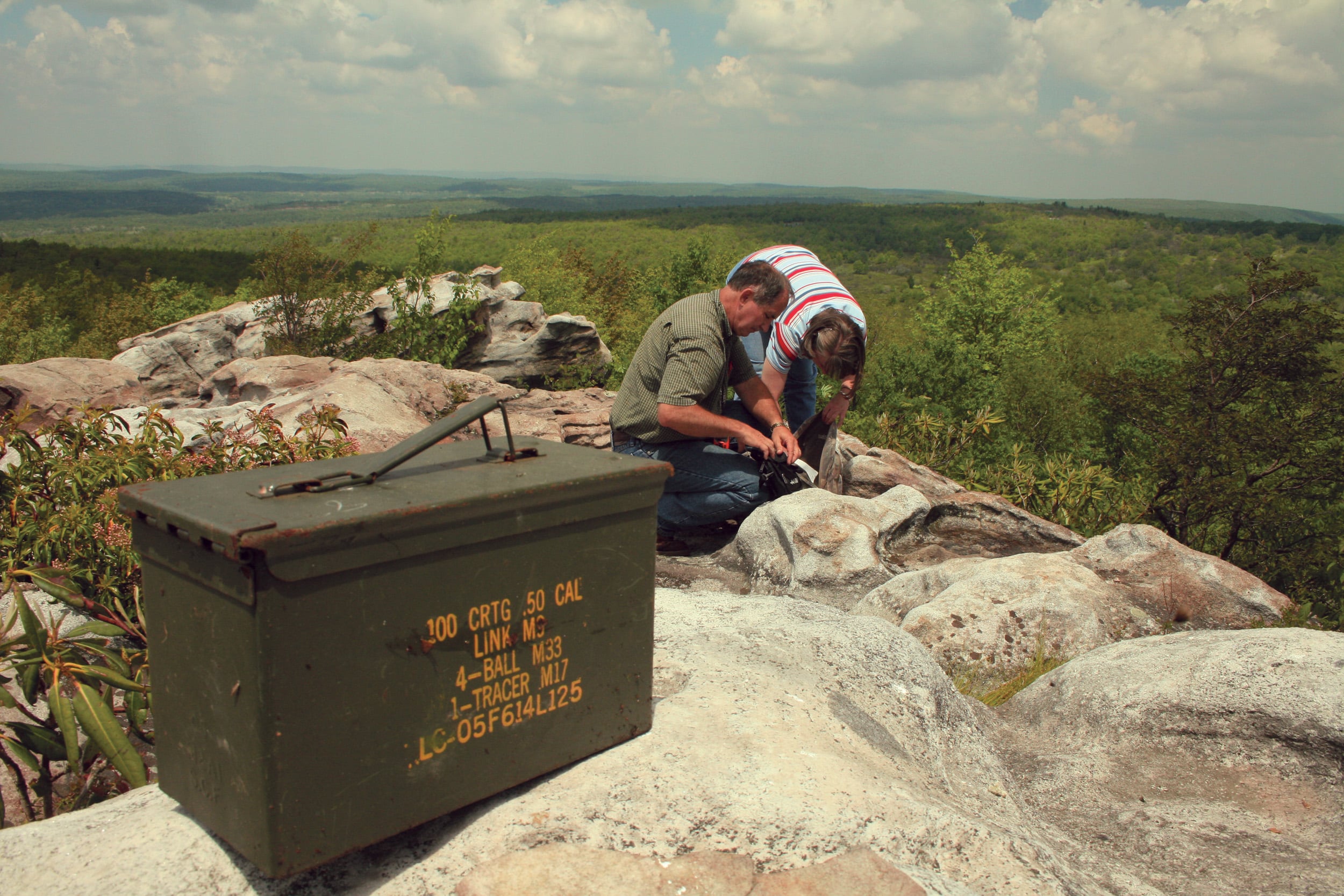
We’re not talking about following a pirate’s map to the site of long-buried booty—we’re talking about geocaching. For folks unfamiliar with the vast world of geocaching, it’s a global scavenger hunt spanning almost three decades. It was once aided by handheld GPS units, but today’s players mostly rely on the Geocaching app and a healthy dose of curiosity. Instead of treasure chests, geocachers search for caches—usually small containers like film canisters or ammo boxes that hold logbooks brimming with signatures, and if you’re lucky, trinkets—using coordinates and clues.
Some caches are hidden in high-traffic locations like a park bench, but others require special skills or gear to locate. To name a few features of an extreme geocacher’s toolkit: a UV light, snowshoes, cross country skies, rock climbing equipment, an off-road vehicle, a boat, a horse, or even a scuba diving suit.
The cache stashed at the Mount Porte Crayon summit was placed back in 2008 and has since been logged online by just 40 geocachers. The limited number of logs isn’t due to a small participant base—southern Appalachia has thousands of active geocachers, locals and geo-tourists alike. But not everyone is up for a 15-mile off-trail traipse through a national forest.
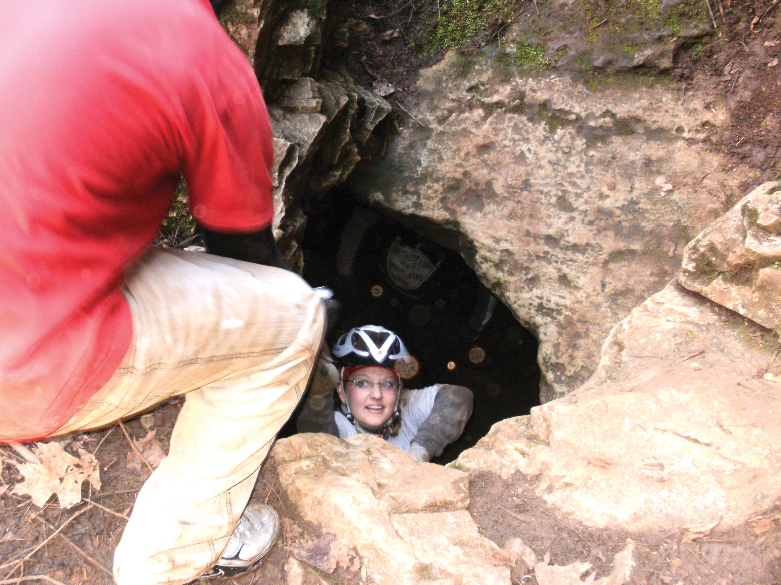
Some extreme caches take you to extreme heights, while others take you to the earth’s depths. “Cave” by Tim Eggleston, AKA WVTim, invites you to crawl, squeeze, and wiggle your way through Whiting’s Neck Cave in West Virginia. Eggleston recommends bringing a flashlight or headlamp—it gets pretty dark down there! Courtesy of Tim Eggleston.
The niche nature of extreme caches like this one is a significant part of the appeal, according to Mark Webb, a lifelong geocacher and organizer of Wild and Wonderful GeoWoodstock XXI and Cachemore, two super-sized geocaching events held in Morgantown, West Virginia, in 2025 and 2026. “Geocaching really is a game for everyone, and you can make it what you want,” explains Webb. “There are a lot of hobbies out there that are complementary to geocaching—like rock climbing, kayaking, and scuba diving. When you get caches that require a very unique skill set and offer a unique adventure, people who do it are going to really, really enjoy it, but it’s a small subsection of the geocaching community. And that’s okay, because there are extreme geocaches as well as more accessible ones.”
That’s the best part about geocaching in Appalachia—our blend of untamed wild spaces and hospitable mountain towns means you can take geocaching to extreme elevations or keep it in close proximity to an iced latte. Because balance is important.
One of the hottest geocaching spots in the region is Berkeley County, West Virginia. It’s home to the globally revered Father of the Gadget Cache, Tim Eggleston—or, as he’s known by his fellow cachers, WVTim. He’s worked with the Martinsburg–Berkeley County Convention and Visitors Bureau to design and stash caches at some of the county’s beloved local businesses and historic sites. Their combined efforts have cemented Berkeley County’s status as the #1 county in the world for geocaching.
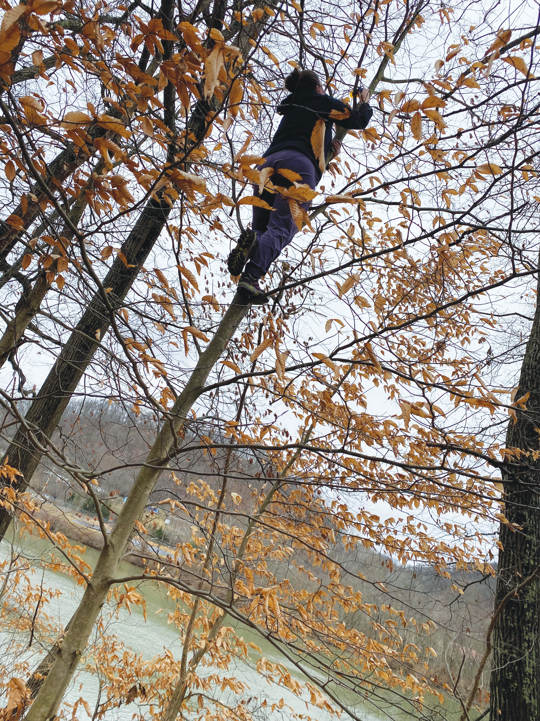
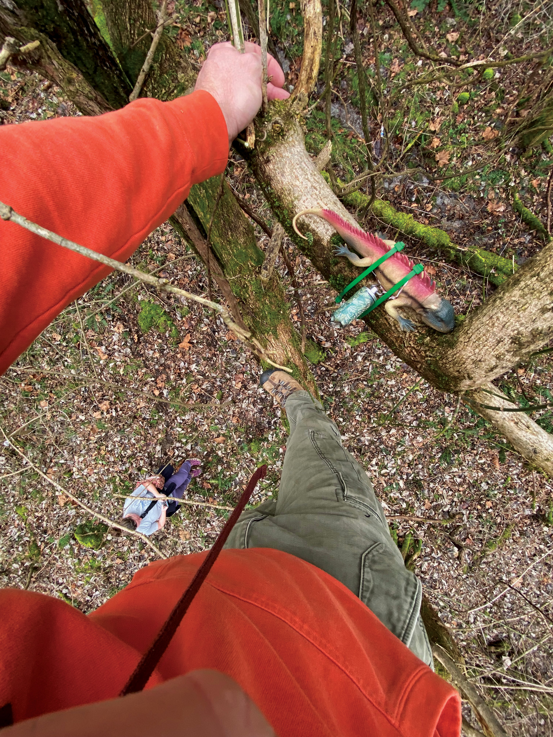
Photos Courtesy of Philip Smith
And the world has certainly gotten the memo. Eggleston estimates that Berkeley County has seen tens of thousands of geo-tourists, and CVB director Mark Jordan has met cachers from as far as Germany and Japan. They choose Berkeley County as their home base while they search for caches across the region and beyond.
“West Virginia is a great state for geocaching. You have rugged mountains and valleys, and a lot of people come here for extreme sports like mountain biking and whitewater rafting, and it just blends with that,” says Jordan. “And it’s such a friendly state. The people are welcoming, and they want to share the beauty of the state with everybody. It’s a great opportunity to bring together the state’s outdoors and its people.”
When it comes to extreme geocaching in Appalachia, you’re guaranteed to find yourself some level of damp, muddy, or thorn-grazed—and we wouldn’t want it any other way. You get to experience some of the most exhilarating thrills in the country, snap photos of a mountain range older than bones, and exercise those treasure-hunting muscles that might have degenerated since the Easter egg hunts of your youth. West Virginia alone boasts more than 5,000 caches. So next time you find yourself summiting a mountain or riding some rapids, check the Geocaching app for nearby caches—bonus points if you’ve got the special skills needed to secure the find. geocaching.com
Tim Eggleston
AKA WVTim, on “Psycho Urban Cache #13 - Impossible! Give Up Now!”
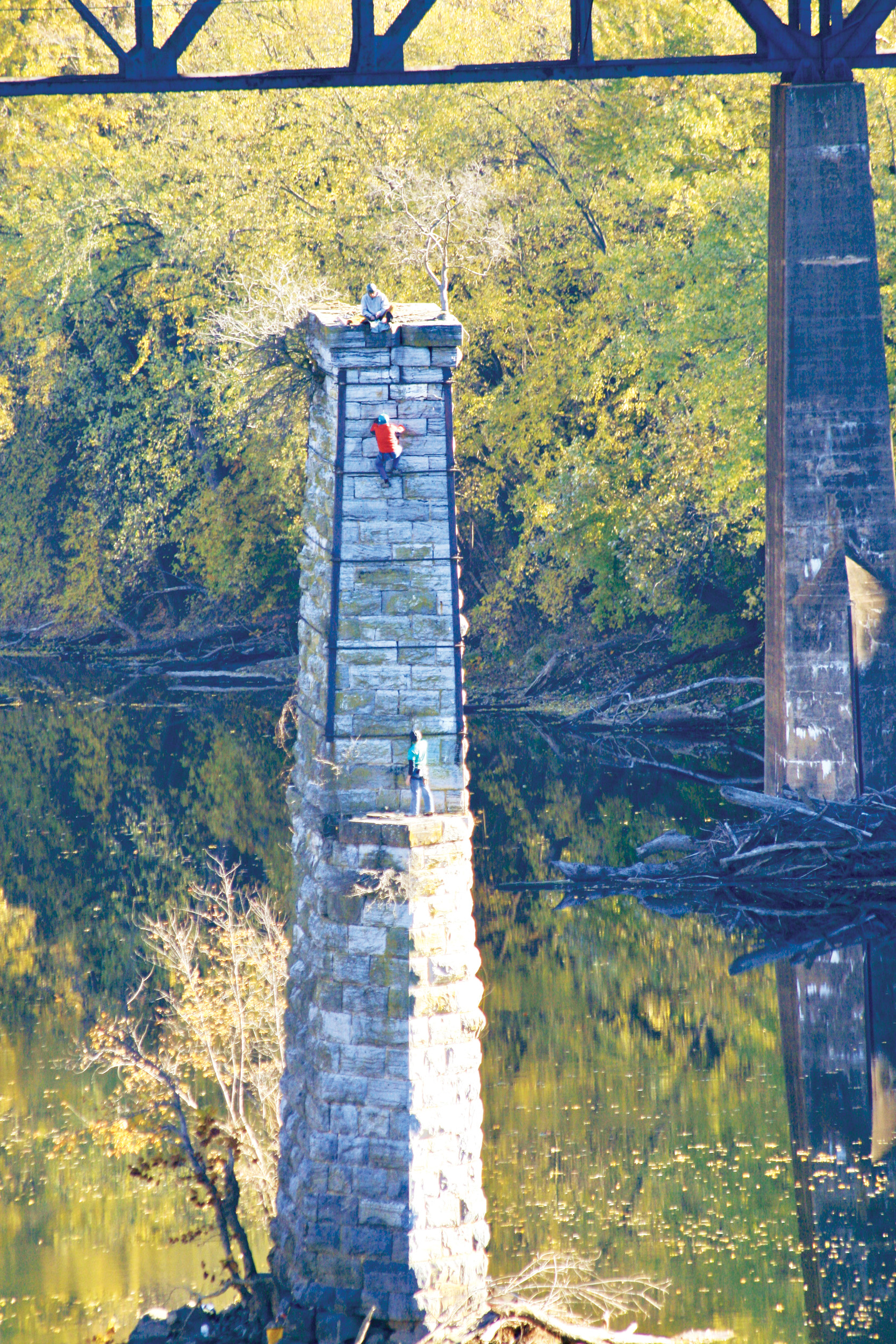
It’s a great cache. It’s on top of a bridge pylon over 90 feet tall, placed with a helicopter. It’s nearly impossible to log. We call them extreme caches—they scare most geocachers to death.
I had explained geocaching to a pair of world-class climbers and they said, “We can get you up there.” So we met in Shepherdstown and rode a canoe across the river. They played rock, paper, scissors to see who got to climb, and then those guys took off. They scaled that thing like monkeys. There were lots of good grabs and plenty of places to place protection as they free-climbed, setting ropes and anchors for me. Once everything was safe, I climbed it. After the top rope was in place, ascension was a piece of cake.
Standing on top was a once-in-a-lifetime experience. It was a beautiful, cool, crisp day, and as I was ascending the tower, a bald eagle flew overhead. It couldn’t have been a better day.
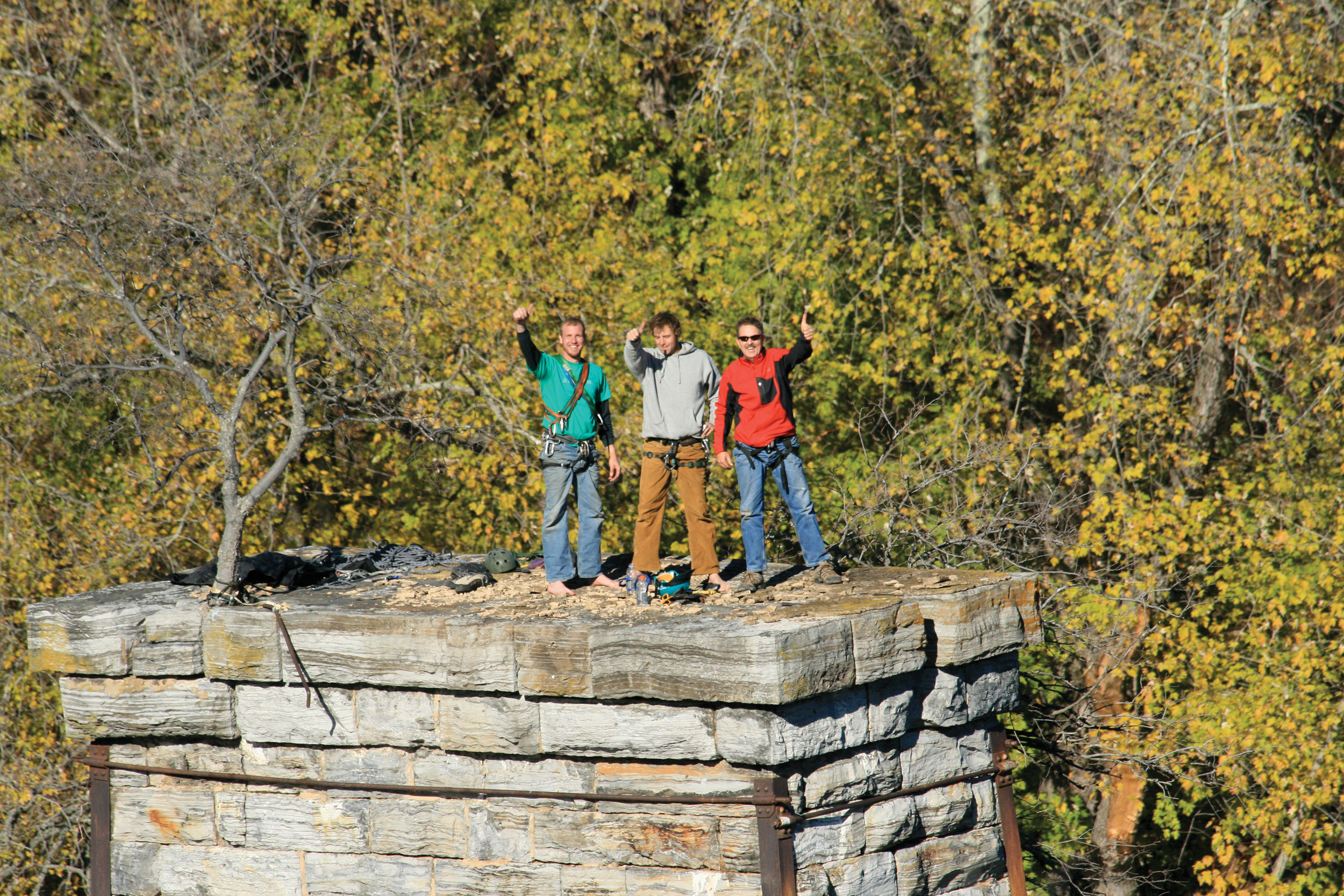
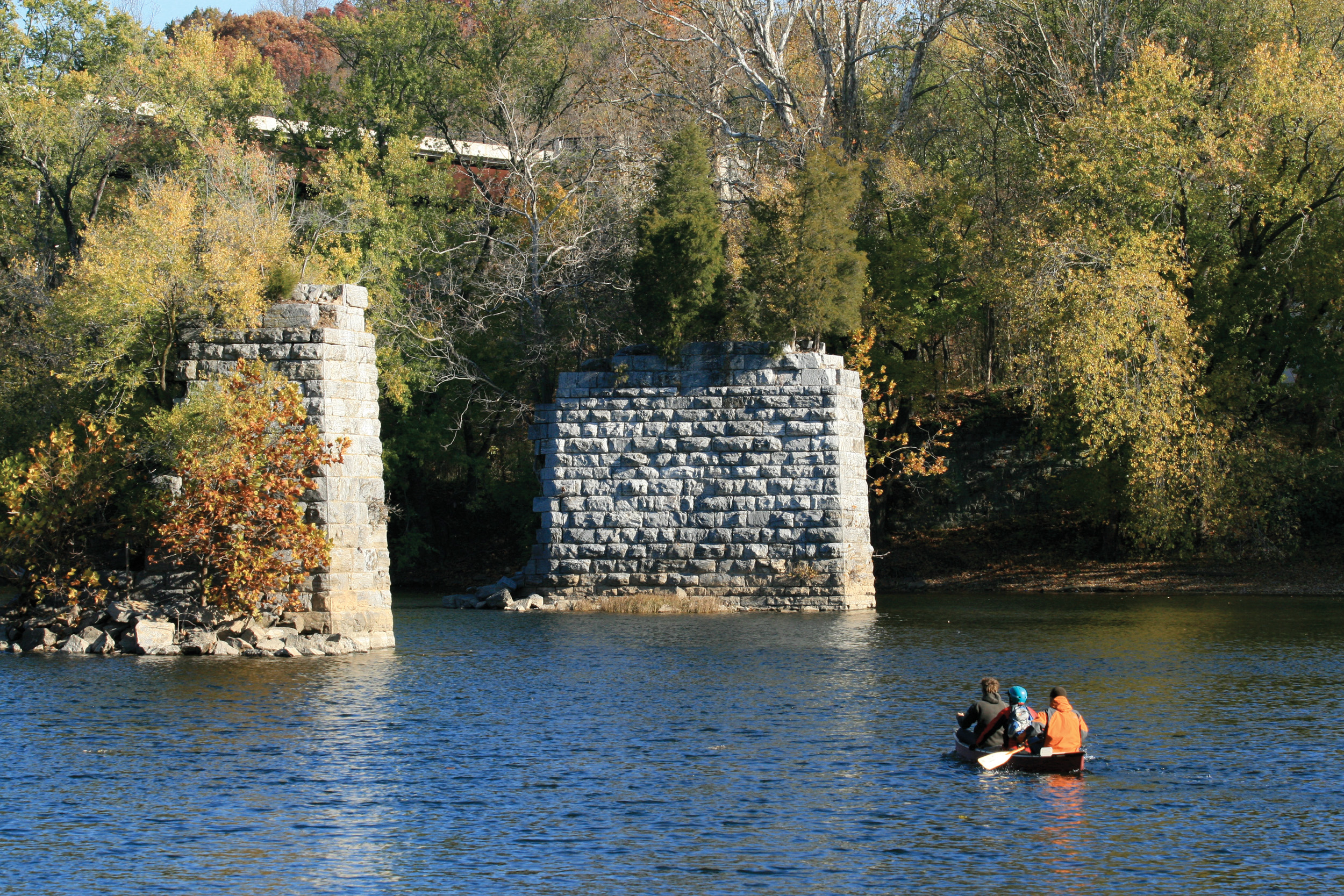
Photos Courtesy of Tim Eggleston
The Cache of the Day
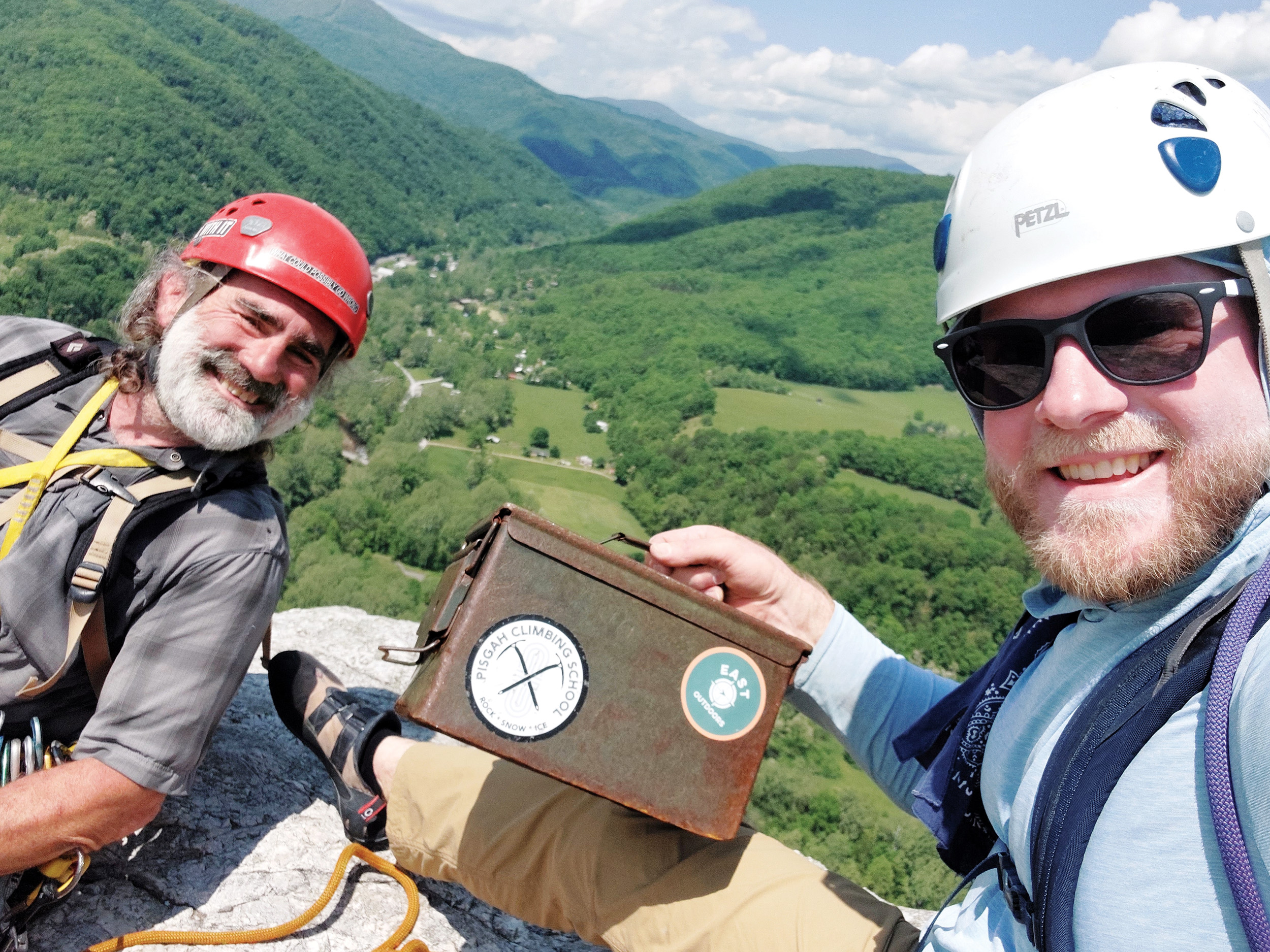
Photo Courtesy of Eric Schott
Itching to hit the trails? Ready to run some rivers? Got a hankering for some campfire s’mores? There’s a cache for every kind of excursion—just please make sure you have the skills necessary to complete it with all your bones intact. Seriously. We mean it.
Bike
Bike Trail: Pick One by GR8Caches
Breeze along the WV Route 9 Bike Path, then dismount and decide which below-highway culvert tunnel contains the cache—then find dozens of more caches tucked along the bike trail.
Camp
North Fork Mountain by Seneca Rocks
The 23.8-mile North Fork Mountain Trail is a hit among backpackers and bikepackers alike for a reason—it’s, like, seriously scenic. And this cache, located near the trail’s halfway point, overlooks some of the best views: Germany Valley, Mount Porte Crayon, Seneca Rocks, and Spruce Knob.
Cave
Cave by WVTim
A fitting name for a cache with a tight fit. Descend a ladder into a 10-foot pit, ascend a second ladder, crawl 50 feet through a tunnel, slide down a 15-foot incline—ugh, we’re dizzy just describing this spelunk into Whiting’s Neck Cave.
Climb
South Peak Summit by ifranz
This cache is located at the south peak of Seneca Rocks. How do you get to it? Scale
a few hundred feet up the cliff face, duh.
Paddle
F.L.O.A.T. #01 through #31 by MarionCVB
Why log one cache when you could log 31? To complete Fairmont’s Land or Aquatic Trail, embark on an 8-mile downstream paddle and keep an eye out for caches attached to overhanging tree limbs.
Ride
Rich Creek Riches by redseal
West Virginia’s oldest cache has a catch—it’s only accessible by ATV. But the Hatfield–McCoy Trail system makes for an unforgettable ride, so who’s complaining? Not us.
Up for an extreme challenge?
Psycho Urban Cache #14: Cliffside Catacombs by Vinny & Sue Team
This cache wasn’t given its name lightly—we will question your sanity if you give it a shot. This three-stage cache east of Shepherdstown, West Virginia, invites you to climb a 65-foot cliff face, squeeze through a narrow underground crevasse, and do plenty of other knee-skinning, ankle-breaking, and head-cracking activities. This one’s for the experts—only skilled geocachers screened by the cache placer are given the coordinates.