

Around this time of year, when the U.S. was still a young nation, flocks of passenger pigeons migrated southward over a future West Virginia. The birds numbered in the millions, according to eyewitness accounts, and darkened the sky for days at a time. It must have been breathtaking.
Of course, none of us has ever seen that—hunting and habitat loss drove the passenger pigeon extinct by 1914. But it does raise the question: What else has changed?
The Smithsonian’s National Zoo & Conservation Biology Institute is asking that question at the national scale. It’s answering it in part by conducting a resurvey of the path that Meriwether Lewis and William Clark’s Corps of Discovery surveyed in 1804–1806.
You might remember from history class that Thomas Jefferson commissioned Lewis and Clark to explore the Louisiana Purchase and find a water route to the Pacific Ocean. To prepare for the expedition, Lewis stocked a boat in Pittsburgh, then floated down the Ohio River to meet Clark. The explorers and their crew mapped the land and documented the wildlife they encountered along the way, giving us a snapshot of the North American wilds before westward expansion.
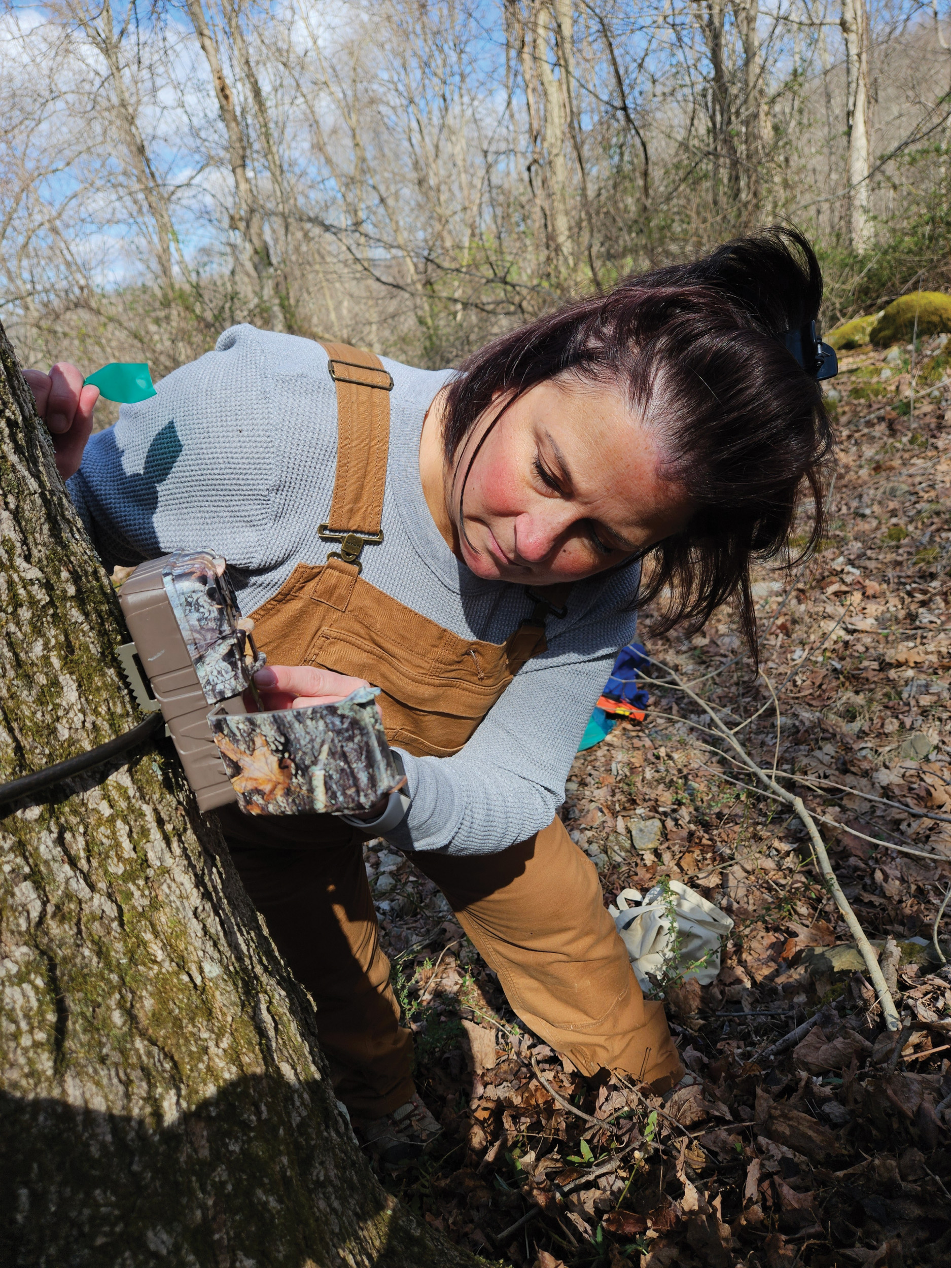
The 2026 Lewis and Clark Resurvey invited partners to collect wildlife observations at locations within 80 miles of the route and, in West Virginia, data collection is taking place at six sites:
- Kanawha County: Wallace Hartman Nature Preserve
- Mingo County: a private site
- Monongalia County: Little Indian Creek Wildlife Management Area and Toms Run Preserve
- Wayne County: Heritage Farm and a site in Huntington
Using the camera trap images and AI tools, scientists will compare today’s biodiversity and animal distributions with the wildlife logs Lewis and Clark kept. The data will be made available to the public in 2027 at nationalzoo.si.edu. Meanwhile, you can help identify the species captured by the Lewis and Clark Resurvey camera traps—at zooniverse.org, click Projects and search “Smithsonian” to get started.